

This walk, about 45 minutes from our home in Coppet, is located in La Sarraz, Switzerland. On a bright and crisp late October Saturday we decided to take the short drive to this place that was described as a "Fairy-like Waterfall" in a blog post I read on Family Earth Trek. What could be a better place for young children to explore than one described as "fairy-like"? And... this walk is mostly flat and short (it took us about 45 minutes to get there (1.5 hours roundtrip) and we took our time with several stops to look for fairy houses).


We went this way:

Instead of this way:


How To Get There:
(Links Connected to Google Maps)
We parked in a parking lot next to a soccer/football field on Route de Cossonay (near to the Route de Dizy intersection).
We then walked to the street and found our walk "Tine de Conflens" posted on a yellow hiking trail sign on the corner near Chemin de la Condémine and Route de Cossonay saying it was a 20 minute walk from this point:

We walked up this street near the river until we got to another posted sign on a metal pole. We turned left here toward the red metal walking man sign and followed the dirt/grass path:

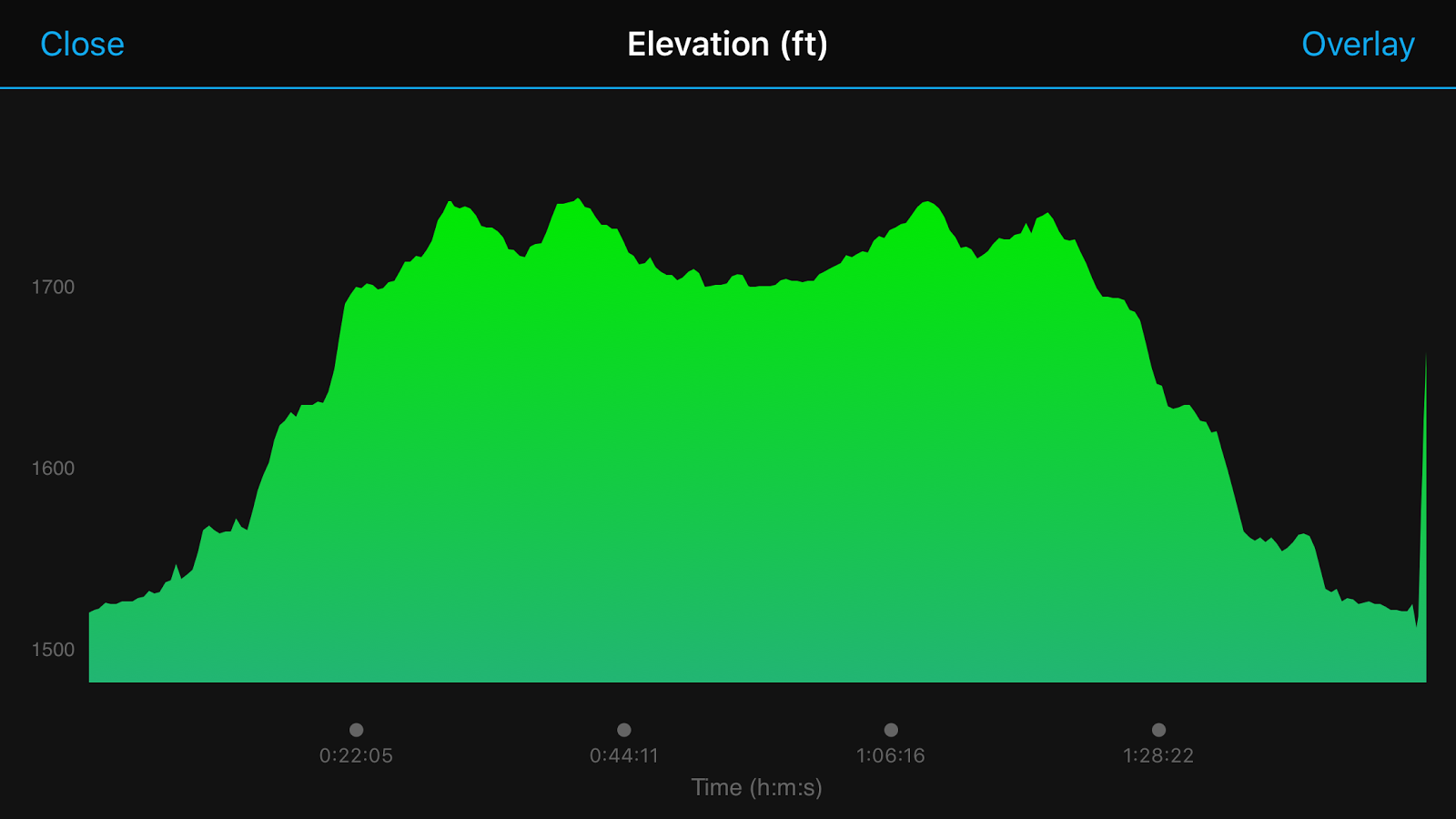
The entire walk was 2.8 KM (1.75 miles) roundtrip and the elevation change was minimal with 477 feet difference.

La Tine de Conflens Photo Album: Click Here


No comments:
Post a Comment
Like It? Leave a Comment!